Text Only
Classical Christian WebMaster: CCH’s Online Catalog: Teacher’s Geography Resources This page last revised: Copyright © 1997-2001 |
Teacher’s Geography ResourcesThese useful tools help parents and children discover geographic knowledge together. Using the Online Catalog
For 1st-6th grades. I looked through dozens of atlases trying to find that one that was detailed without being overkill, readable without eyestrain, with maps that were beautiful and pleasant to look to at as well as utilitarian. I was very impressed with NG’s World Atlas for Young Explorers. The introduction is clear enough for children to read and understand on their own, covering the topics of using an atlas (including how to use grids to find an entry in an index), nice explanations of how the three-dimensional world is portrayed on two-dimensional paper, kinds of maps, reading maps and using legends, and geological information about the earth: how it’s positioned in the solar system, our atmosphere, time zones and seasons, the earth’s composition, tectonic plates, and landforms; and thematic maps of climate, population, and so on. It includes vocabulary and definitions throughout, such as isthmus: a narrow strip of land that connects two larger landmasses and has water on two sides. The atlas itself is divided into seven sections, one for each continent. Beautiful photographs of that continent from space introduce each section, followed by a physical map clearly showing all the major geologic features a child would want to memorize for that continent, without cluttering the map. Side bars give area, highest and lowest elevation, longest river and largest lake, and then have the sense to quit. Beautiful NG photographs depicting different aspects of the continent illustrate the introduction to each section. The political maps that follow are up-to-date, easy to read, and show the major cities, rivers, flags, capitals, and economic products of each country. The Atlas concludes with a facts and figures quick file, a nice glossary, and a place name index. Although this atlas is probably not detailed enough for secondary work, it is perfect for the grammar stage and a child’s introduction to maps. It includes all the information a child should memorize in the grammar stage without being overwhelming.
For all ages. When children have outgrown the simpler NG atlas
above, this one will carry them through their entire education with accuracy and style.
The state-of-the-art cartography department from DK has created the most up-to-date
detailed and embellished maps ever produced in one volume. This atlas features the latest
digital satellite data, as well as abundant economic, demographic, environmental and
cultural information, and includes over 800 full-color photos and illustrations. The maps,
models, and illustrations are computer-generated and incredibly realistic and brilliantly
colored. DK’s trademark photos illustrate cities, villages, and natural wonders. The
atlas begins with a section detailing the solar system, the structure of the Earth, the
oceans, the global climate, and international boundaries and disputes. The main body of
the atlas is grouped by continents, each broken down by country or region. The index and
gazetteer includes all 80,000 geographical names mentioned in the book and a breakdown of
the statistical information of every country. The attractive layout and illustrations
invite browsing, and as the atlas is filled with interesting bits of information, it is an
absorbing and entertaining reference.
For all ages. “Set aside a little extra time when
you’re looking up information from the DK World Desk Reference--you won’t be
able to keep yourself from browsing. The large, gorgeous pages are colorful and well
designed, and while the facts you need are readily available, their neighbors are
clamoring for your attention, too. Beginning with a set of physical, historical, and
economic maps of the world and its continents, the Desk Reference quickly gets to its
heart: several pages devoted to each nation of the world (as of the year 2000), from
Afghanistan to Zimbabwe. Clear, detailed maps, synopses of political, economic,
environmental, historical, and demographic information, and exquisitely helpful charts
bring each country to life and serve as a brief but thorough lesson on its place in the
world. The four-page spread on Yugoslavia will help you understand the situation there
better and faster than a pile of history textbooks, and your awareness of the importance
of groups such as the G7, WTO, and IMF will expand tremendously after just a few minutes
of browsing. Despite its entertainment and educational value, though, the DK World Desk
Reference is also a sharply focused reference tool: The index and gazetteer will bring you
to the right page without fail time and again.”
For the 3rd-6th grades. From Bosnia to Zaire, this well-organized
text clearly explains geographic concepts, which can be difficult for grammar stage
students to grasp. Scholastic uses colorful graphics and understandable language to bring
the subject into the grasp of students, and is filled with visual aids, timelines, charts,
graphs, and maps. This teacher’s resource concludes with a detailed index for making
on the spot lookups easy.
For the 3rd-6th grades. Subtitled: Easy Activities that Make
Learning Geography Fun. The grammar stage is all about facts and memorization, but who
says classical education can’t be fun too? Not me. I’m all for relieving the
monotony with stories of other people and places, and interesting projects such as
described in this helpful book. Topics such as map projections, time zones, reading and
making maps, determining scale, the location of the earth’s weather patterns and
latitude and longitude are introduced through easy activities. Each activity (such as
making a compass rose or plotting the track of a hurricane) includes step by step
instructions and uses readily obtained materials. “VanCleave’s method encourages
critical thinking while providing fun, and an abundance of simple, clear diagrams help
explain the projects.”
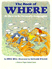
For the 4th-6th grades. Subtitled: Or, How to be Naturally
Geographic. This is a Brown Paper School Book, and follows the same humorous style of the
others in the series. Like the Janice VanCleave book, use this as a resource for ideas and
activities to present geographic topics such as scale, maps, the globe, continental
plates, the oceans, etc. in a fresh and appealing way. Each section, which progresses from
bedroom to block, city to state, and country to the globe, includes well-designed
questions that require students to use maps, globes and other data sources (such as
atlases and the DK World Desk Reference) to find the answers. Illustrated and
embellished with cartoons, jokes, riddles, and stories.
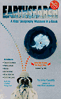
For 4th-6th grades. This is a different sort of book. First of
all, it’s from Klutz, and that tells you right there that it is more about kids doing
stuff than kids simply reading stuff. Featuring 18 exhibits, ranging from recycling,
rocks, foreign coins, mazes, population clock, economic and population density
distribution games -- using M&M’s -- that illustrate facts without using the
usual boring charts. Its 110 pages will fascinate kids and keep them coming back over and
over again.
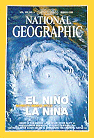
For the 5th-6th grades; and secondary students and adults. I highly recommend the National Geographic Magazine for use in developing geographic awareness in our children. The articles are challenging for children, but reading and understanding them stretches and develops their vocabulary while teaching them about our world. The magazine routinely comes with maps which greatly enrich geography, history, and even science study (they have produced beautiful star charts and “maps” of the solar system, for example). We have found their game of geographic trivia, Global Pursuit, which teaches map familiarization and geographic and historical knowledge in a fun way, very helpful. However, the National Geographic Society is almost evangelistic in its evolutionary zeal, so use their science materials with care. Answers in Genesis counteracts NG’s evolutionary misconceptions with sound science.
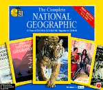
Software for all ages. For those of us that pick up old National
Geographics at yard sales hoping to have a complete set one day to use in school, one day
has arrived. This CD ROM collection contains all the National Geographic magazines from
1888 through 1999. All the gorgeous photographs, articles, even advertisements--it’s
like browsing a magazine from your collection on the computer screen. There is a search
engine which makes trips to the library to use the National Geographic Reader’s Guide
unnecessary. Plus, think of all the space you can save on your bookshelves and in your
closets by selling all your old magazines at a yard sale this summer! These benefits make
the product worthwhile for serious homeschoolers. Now for the down side: Since there are
over 30 CD’s in the set, switching CD’s can be cumbersome when performing
searches. Using the search interface requires patience -- it needs to be overhauled by
some bright young software engineer with a little more common sense. And some of the
screen displays from pre-1940’s magazines require zooming in to be legible. The
articles are not in text files, so printing an article is like printing a scanned page
from a magazine -- a graphic file. Let’s hope National Geographic corrects these
problems with future editions, but even so, this is still a very useful and time-saving
tool. This set contains all the maps bound into the magazine, but the extra supplemental
maps are not included. They are available separately below.
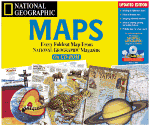
Software for all ages. National Geographic Maps 2.0 takes every
foldout, supplemental map from the pages of National Geographic Magazine from the last 109
years (through 1995) and brings them together in CD-ROM form. These maps span the complete
geography and history of the world, integrating the two through interactive time lines.
Pictures, sound, and video clips accompany many of the maps. Program features allow you to
zoom and pan on maps for a macro- or microview. You can easily locate an exact point on
the map with the map navigator. Search for maps by key word, geographic location, or
theme. Another bonus: you can copy, paste, and print maps directly into your reports and
presentations. Includes nine multimedia map tours of various themes like Peoples of the
Past and Space. Interactive timelines trace the history of cartography. Disk swapping
among the eight CDs continues to be a nuisance.
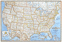
For all ages. This is the standard size,
43-1/2"x30-1/4", political wall map of the United States. It is laminated for
extra durability and longevity, and comes rolled in a tube, so there are no crease marks
to obsure the print and map details. The same map also comes unlaminated --
simply a paper map -- in the same size, and also rolled in a tube, for a little bit
less.
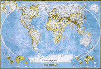
For all ages. This is the standard size,
43-1/2"x30-1/4", political wall map of the entire world. Produced in the summer
of 1998, it contains the latest political boundaries and country and city names. It is
laminated for extra durability and longevity, and comes rolled in a tube, so there are no
crease marks to obsure the print and map details. The same map also comes unlaminated --
simply a paper map -- in the same size, and also rolled in a tube, for a little bit
less. Using the Online CatalogThis online catalog is made possible through an association with Amazon.com. Clicking on the book cover will take you to Amazon’s information page about that book. You can look at its price, availability, any discounts currently taken for that title, reviews of the book, and other information, as well as order it if you decide to purchase the book. You can even place books in your shopping cart and save them for purchase at a later time. You can continue to add or delete books from your shopping cart until you are satisfied with your order and ready to purchase. Clicking on your browser’s “Back” button will bring you back to this catalog. Sometimes books go out of print, or the publisher runs out of stock. Any book not available from Amazon.com for any reason can be searched using AddAll.com, a book shopping site which will scan Amazon as well as Barnes and Noble, Powell’s Books, Book Close Outs and many other new and used book sites. Be sure to also check BookFinder.com for out of print book searches. Still have questions? Ask me! Return to the CatalogCCH’s Geography CurriculumGeography in the Grammar StageOnline Catalog IndexClassical Curriculum and Online Catalog
|
Home ××× Contents ××× About ××× New ××× Curriculum ××× FAQ
|